Journey through the ecological corridors of Greece and Italy
Read about each area virtually to see the key locations where we will develop the LIFE Bear-Smart corridors actions.
Photos, videos and interesting insights from the field will be added in time to promote shared initiatives with the residents and to spread as much as possible the culture of human-wildlife coexistence.
ITALIAN AREA
In Italy, the area where the activity of the LIFE Bear-Smart Corridors takes place extends over the Central Apennines, a massive mountain range that has a diverse landscape from peaks over 3000 meters to deep gorges, alpine meadows and prairies and some of the most ancient beech forests of Europe. The Marsican brown bear, Apennine wolf, red deer, Golden eagle, Griffon vulture are found here alongside a myriad of other rare or endemic fauna and flora.
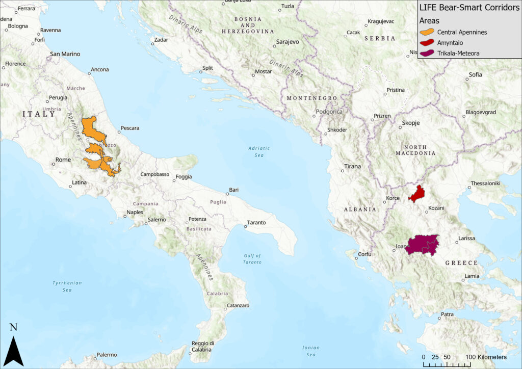
The project area encompasses 2,400 km2, and is looking to improve conditions for the endemic and endangered sub-species of Marsican brown bear in four critical ecological corridors, defined also as “coexistence corridors” covering 1,100 km2. These corridors connect the main protected areas of the region, such as the Abruzzo, Lazio and Molise National Park, the Maiella National Park and the Sirente Velino Regional Park. We focus on the connection between the local communities and wilder nature as a means to expand the bear population while maintaining coexistence.
Abruzzo, Lazio and Molise National Park (PNALM) to the Sirente Velino Regional Park (SVRP)
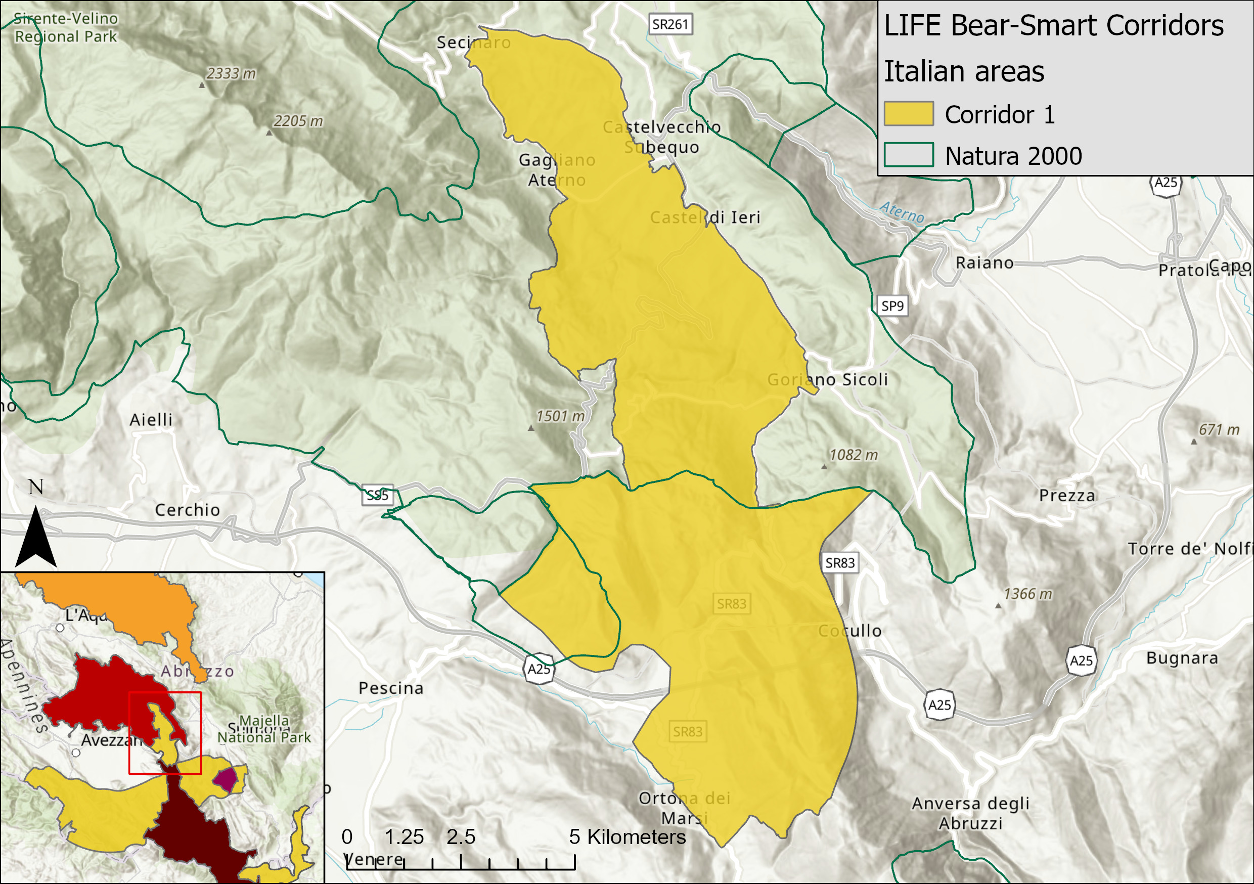
This corridor extends over 75.43 km2 and connects the Abruzzo National Park (PNALM) to the Sirente Velino Regional Park (SVRP) via a high-altitude ridge of open alpine pasture above partly wooded slopes and more recently abandoned agricultural land.
The A25 Highway runs through the corridor creating a barrier in the valleys but runs through a long tunnel under the main ridge, with only the rather minor SP60 road (Ortona dei Marsi to Coucullo) impeding progress on the main ridge. The villages in the corridor have all suffered from depopulation but traditional agricultural practices are still taking place, attacking also tourists.
Main challenges here are: collisions with wildlife, inappropriate rubbish disposal systems, barbed wire impeding movement and human-wildlife conflict. We are very glad to be working with several bear-smart communities here as well.
Abruzzo, Lazio and Molise National Park - Monte Genzana Alto Gizio
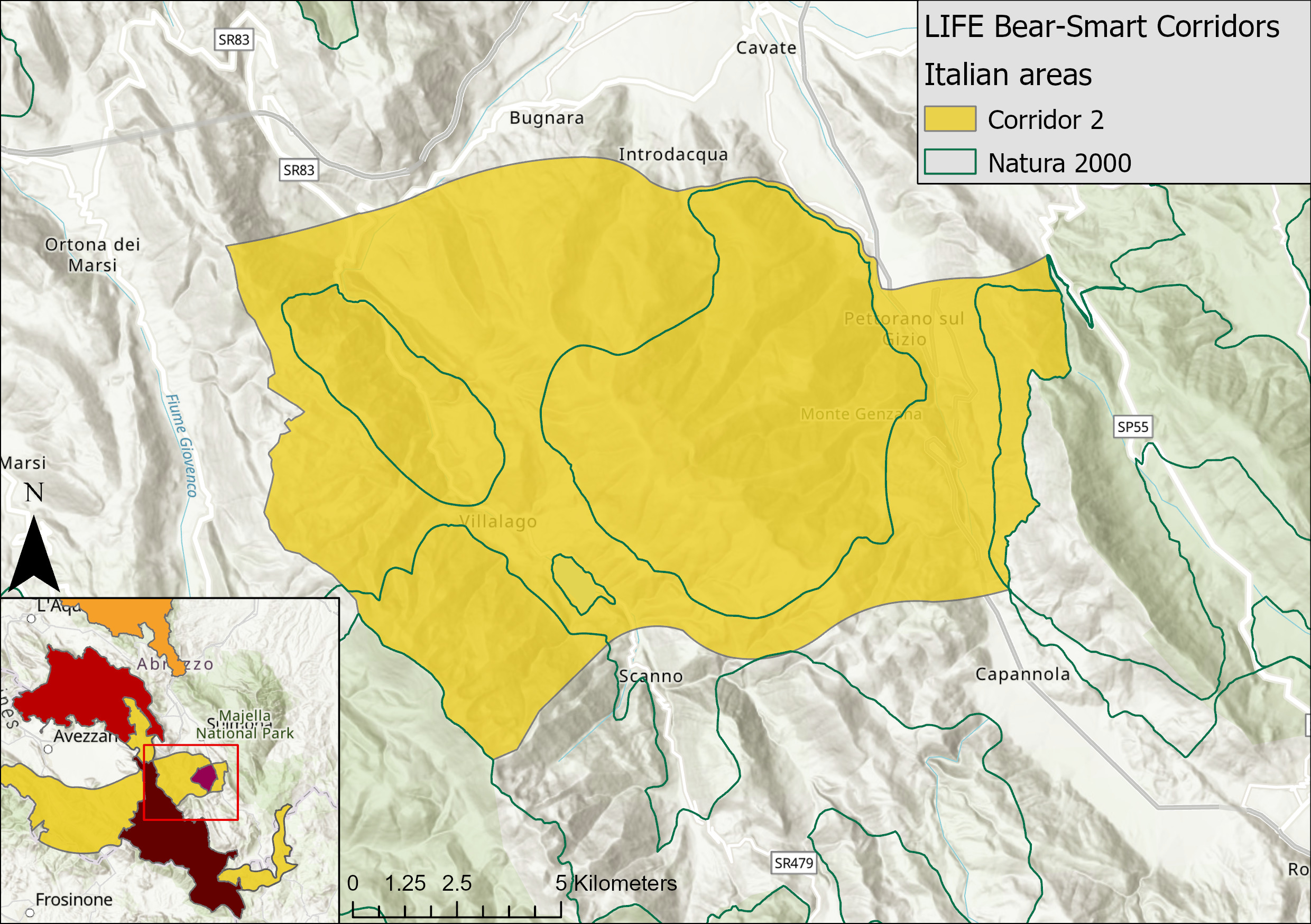
This is an ecological corridor connecting the National Parks of Abruzzo, Lazio and Molise with Majella via the Sagittario river gorge and the Mount Genzana including the main settlements of Scanno, Villalago, Anversa degli Abruzzi, Introdacqua, Bugnara and Pettorano sul Gizio. This area has stunning medieval villages and beautiful scenery. Monitoring has shown that the corridor is also important for wild cat and Apennine wolf and certainly has potential for Apennine chamois range expansion from Majella National Park into the Genzana Mountain area.
The corridor is particularly important for bears with breeding bears in the Gole del Sagittario area. Current issues for bear dispersal include human-wildlife conflict and possible Highway 479 collisions.
The Genzana Bear-Smart Community was established in 2015 as the first pilot in Europe.
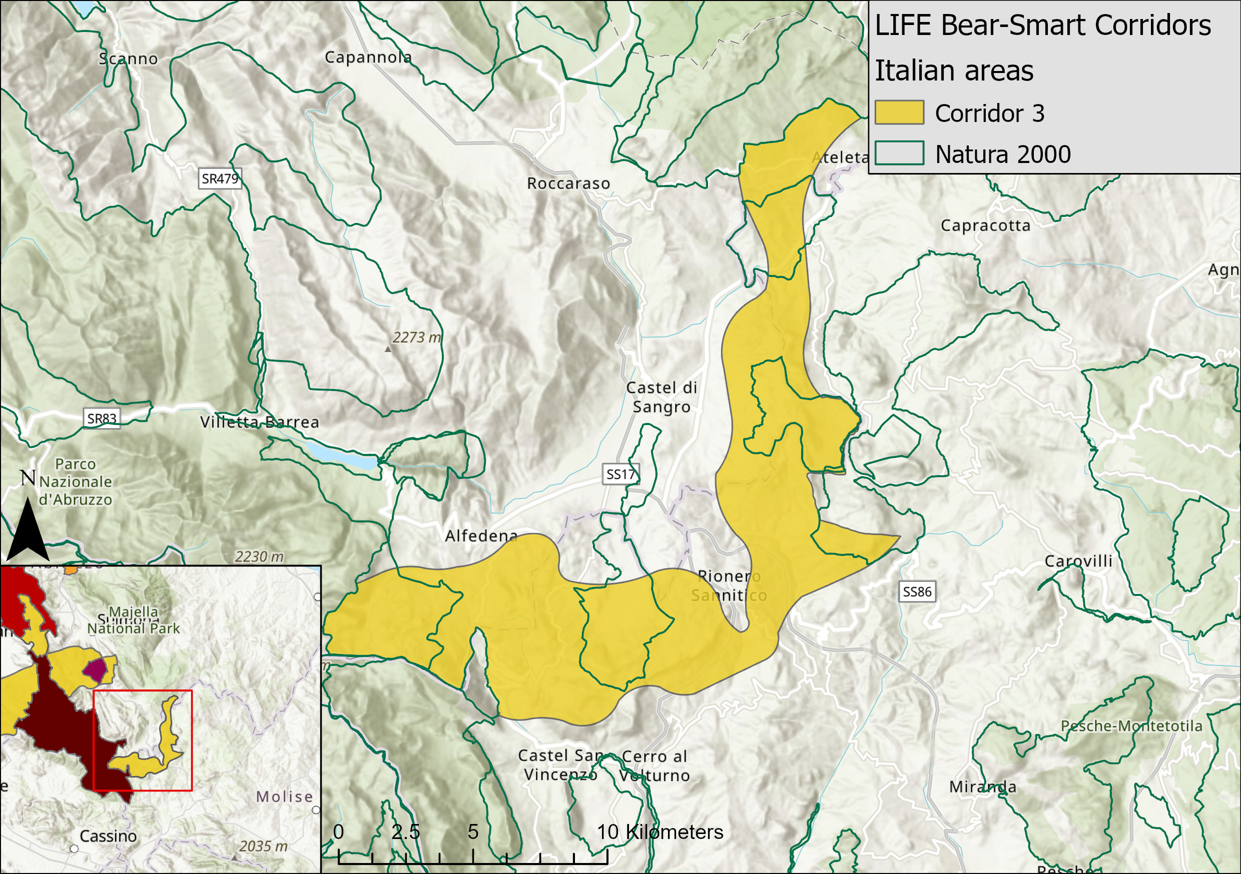
Abruzzo Lazio and Molise National Park - Collemeluccio Montedimezzo Alto Molise Biosphere Reserve (MAB)
This corridor stretches from the southern portion of the PNALM to the northern area of Collemeluccio Montedimezzo Alto Molise Biosphere Reserve (MAB). Beech forests and a valley with limited agricultural use dominate the landscape. The high biodiversity is ideal for the expansion of the bears on a southwards range from the Abruzzo Lazio and Molise National Park.
The Bear Smart Community San Pietro Avellana-Vastogirardi and the Bear Smart Community of Pizzone will assist us in mitigating the threats towards the bears such as hunting that leads to accidental killings, poaching, poisonings and infrastructure fragmentation and wildlife-vehicle collisions on the Highway SS652.
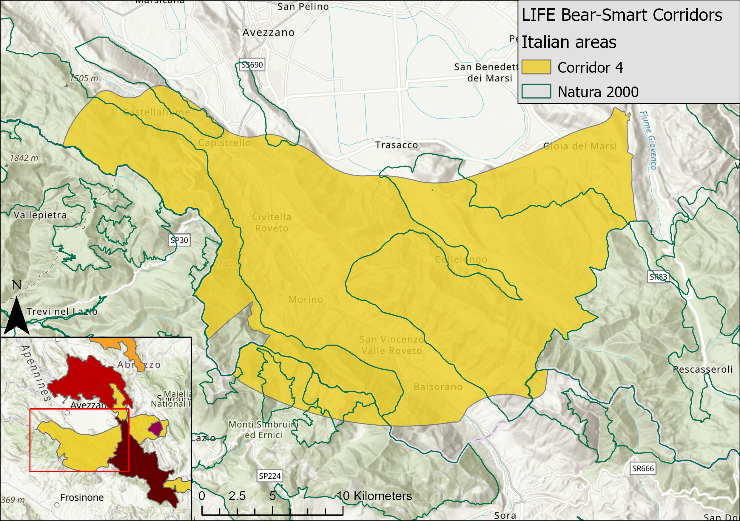
Abruzzo Lazio and Molise National Park- Ernici-Simbruini Regional Park
Linking PNALM to the Ernici-Simbruini Regional Park and including 11 municipalities, this is a critical corridor for bear expansion. It is split NW-SE by the State Highway from Avezzano to Sora. The corridor includes the Roveto Valley with 30 km of the River Liri. The landscape is dominated by woodland and alpine pastures.
Bears have been recorded in the corridor frequently, but they are under threat due to grey infrastructure fragmenting the landscape, poaching and risk of poisoning by locals who are traditionally resorting to poison to fight against “pests” (stray dogs and wild carnivores) or to kill competing truffle-searching dogs.
If the corridor conditions were improved, in time, the Ernici-Simbruini Mountains would be able to support the highest population of bears outside PNALM. Helping us do so are the bear-smart communities of: Gioia dei Marsi and Morino.
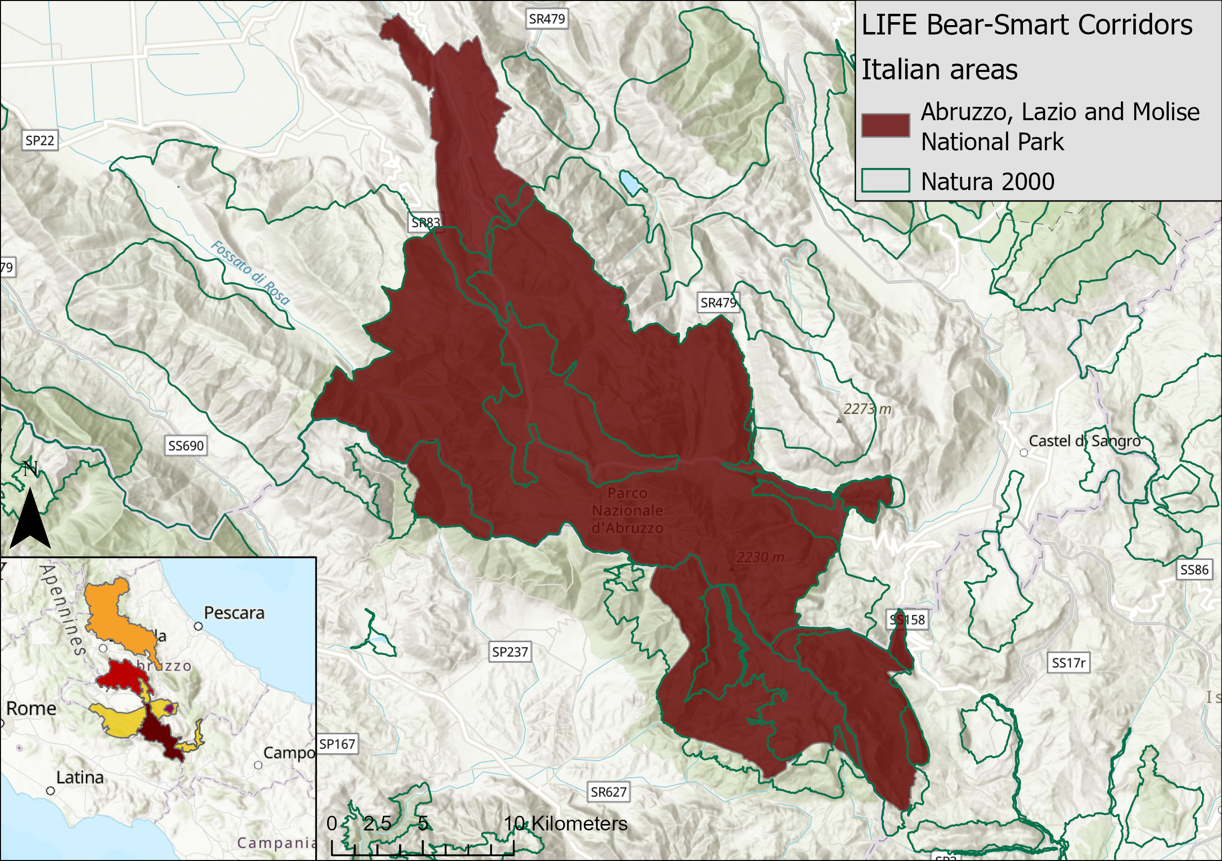
Abruzzo, Lazio and Molise National Park (PNALM)
The PNALM is mountainous and largely forested, extending along the Central Apennine chain.
It is a core area for the Marsican Brown bear, and has a high natural value due to the presence priority habitats and species (Apennines Wolf, Apennine Chamois, Rosalia alpina, Osmoderma eremita, Dalmatian woodpecker, Ursini's viper, and European otter).
The Marsican brown bear population was recently estimated at between 47 and 61 individuals through genetic sampling (through the LIFE Arctos project) and the Park is considered to be at full occupancy such that population expansion can only occur through range expansion. In the peripheral parts of the park, bear population levels are low restricted to a few wandering males although breeding females are found around the periphery of the park and that is why well-managed coexistence corridors are essential for the survival of the species.
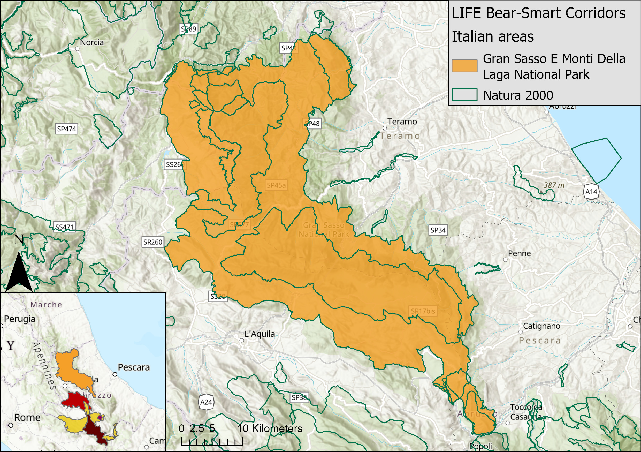
Gran Sasso e Monti della Laga National Park
The Park is one of the largest in Italy consisting of three mountain groups: Gran Sasso d'Italia chain, Laga massif, and Gemelli Mountains. The highest peak of the Apennines, Corno Grande (2,912 meters) and the southernmost glacier in Europe are located here. It hosts a variety of animal species, most notable being the Apennine chamois (Rupicapra pyrenaica ornata) and a Marsican brown bear that has been reported several times in the park proving that the bear range is expanding through the Majella National Park and into Gran Sasso National Park (PNGS).
Improving the bear dispersal corridor from Abruzzo Lazio Molise National Park (PNALM) through the Majella National Park would allow bear numbers to increase. Building coexistence between bears and people living and visiting the Park is crucial, thus possible bear-smart communities were identified.
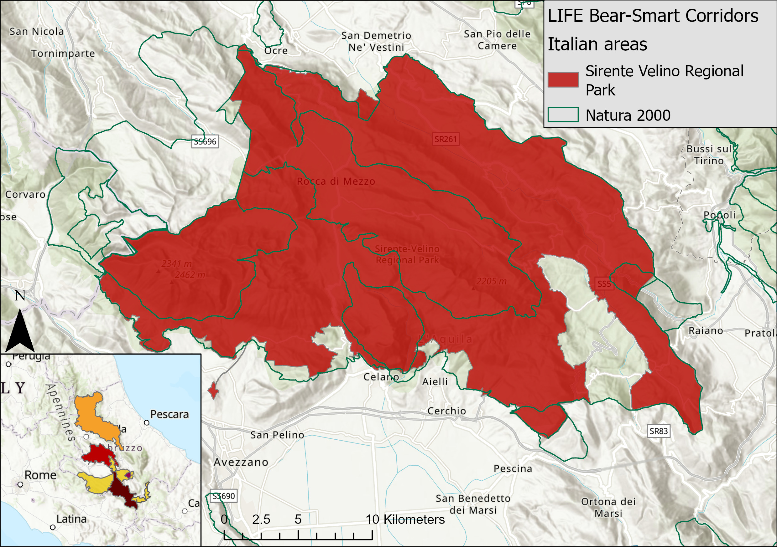
Ente Parco Naturale Regionale Sirente Velino (PRSV)
The PRSV is centred on the Sirente (2348 m) and Velino (2486 m) massifs with an altitude range between 600 and approx. 2,500 m.
The PRSV is both an important peripheral area to PNALM for Marsican brown bears and as a dispersal corridor to link PNALM with suitable habitat to the north (Gran Sasso). Monitoring of bears in the Sirente-Velino area (linked to LIFE projects 994NAT/IT/001140; 98NAT/IT/005114; and 03NAT/IT/000151) shows continuous presence of low numbers of bears including wintering and breeding presence (Morini et al., 2016).
The main threats to bears in the area relate to barbed wire, disease, and poisoning in retaliation of damage to livestock.
GREEK AREA
Biodiversity is in decline worldwide and effective conservation measures are necessary for maintaining intact ecosystem processes and securing human survival. One of the main aims of the LIFE Bear Smart Corridors project is to safeguard the functionality of the important movement corridors for bears in the project areas. Recent genetic research in the country has indicated two such corridors that connect bears from Trikala to Amyntaio and from there further north. Corridor functionality will be evaluated through three different, but complementary methodologies:
- Genetic sampling and analysis
- Phototrapping,
- Geographic Information System (GIS) analysis, which will combine all the data above and evaluate corridor functionality.
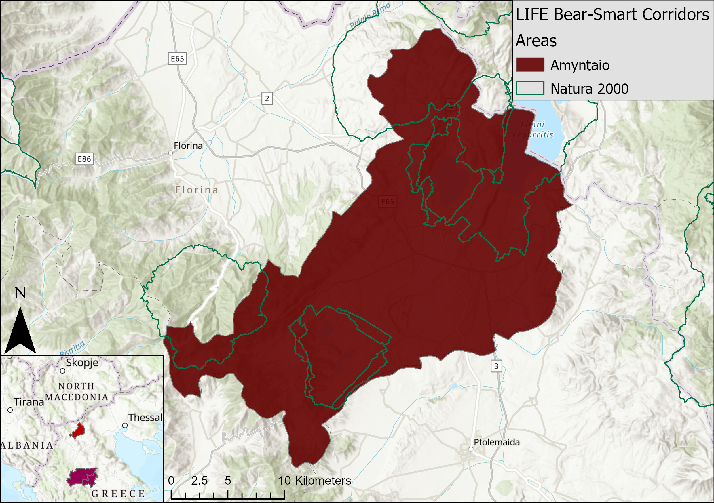
Municipality of Amyntaio
The corridor is located in the NW part of Greece, which borders Albania and Northern Macedonia. This is an area with a diverse landscape and a high degree of biodiversity. It supports one of the most powerful sub-populations of Ursus arctos in Greece.
The Municipality of Amyntaio is a rural area, as the crop fields and the pastures occupy 2/3 of the total area.
The same areas that are characterized as important habitats - host rare or endangered species - are also teaming with human activities. This can sometimes lead to conflicts between stakeholders that favor different land uses. It also means consultation, discussion & balancing the different needs of society and nature. After all, productive activities such as agriculture and livestock breeding are an integral part of the natural processes of the landscape.
Area of Trikala, Pyli and Meteora
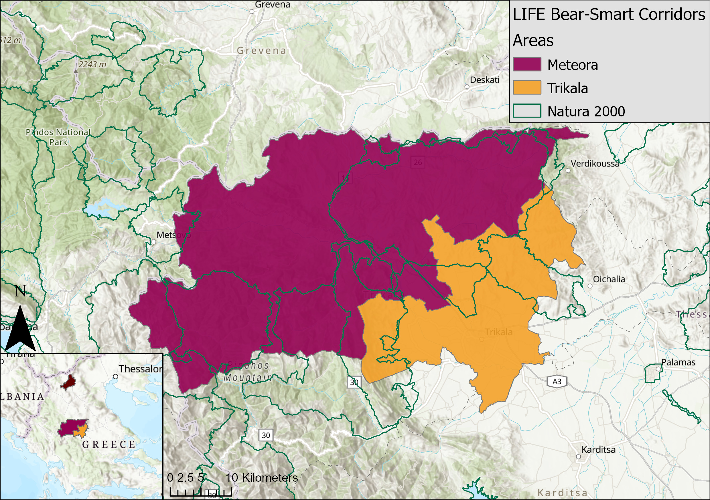
The corridor covers the mountainous area of Trikala, Meteora and Pyli that occupies the north-western part of Trikala Regional unit including the mountain complex of Antichasia and Kalambaka-Meteora in the south. The area is covered with forests or pastures and only a small part is agricultural land or other forms of settlements or wetlands.
The biodiversity value of the area is exceptional due to it's great botanical and zoological value. Here we can find the presence of a large number of endemic and threatened species, legally protected at a national and international level (3 NATURA 2000 sites). The
Ursus arctos sub-population present is a crucial part of the overall bear population in the country (at ca. 25-30%).
In addition to its ecological value, the site has a great aesthetic and cultural value and also acts as a major touristic destination worldwide due to the presence of the singular rock formations of Meteora that have been designated as a World Heritage Site (UNESCO).
